Valley Capital Formation
The Asakura leadership consolidated Echizen power and established Ichijodani as a strategic seat, organizing the valley as a controlled urban and military core.
A deep-dive into one of medieval Japan's most important regional castle cities. This page covers location context, the rise of the Asakura domain, the violent fall of the city in 1573, and its rediscovery through major archaeological work beginning in the 1960s, alongside Takao's supporting role in the wider valley system.
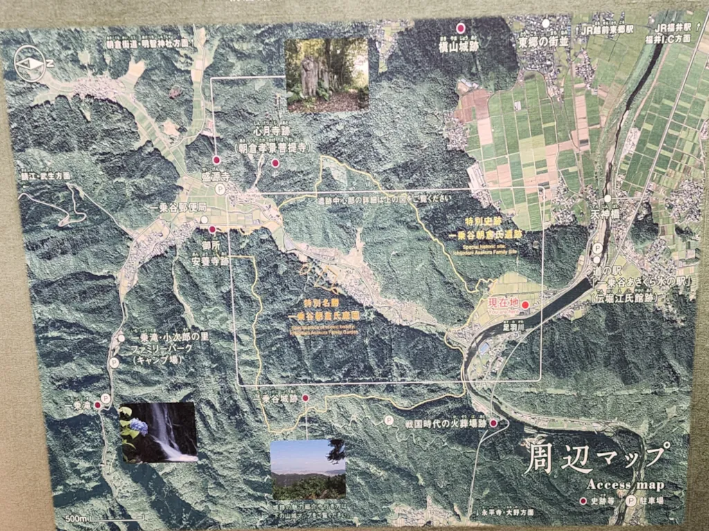
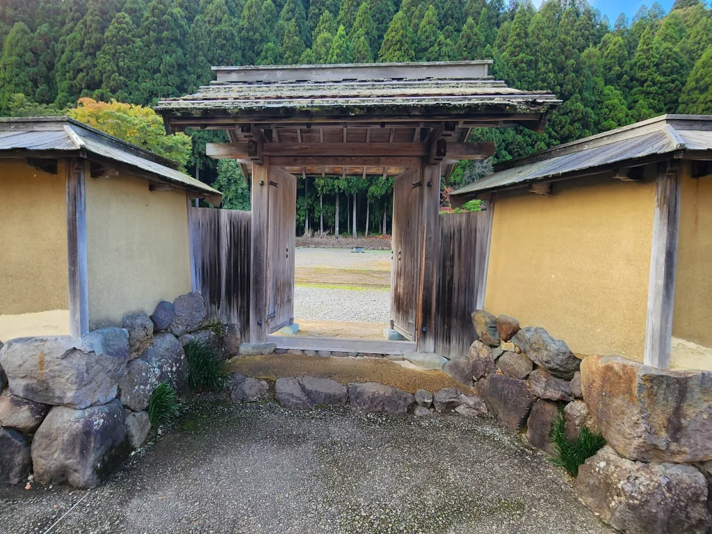
Ichijodani lies in a protected valley southeast of central Fukui City, framed by low mountains and river corridors that made it defensible and economically productive. During the Sengoku period, it developed into the seat of the Asakura clan in Echizen, functioning as both a military-administrative center and a lived city of samurai, merchants, artisans, and religious institutions.
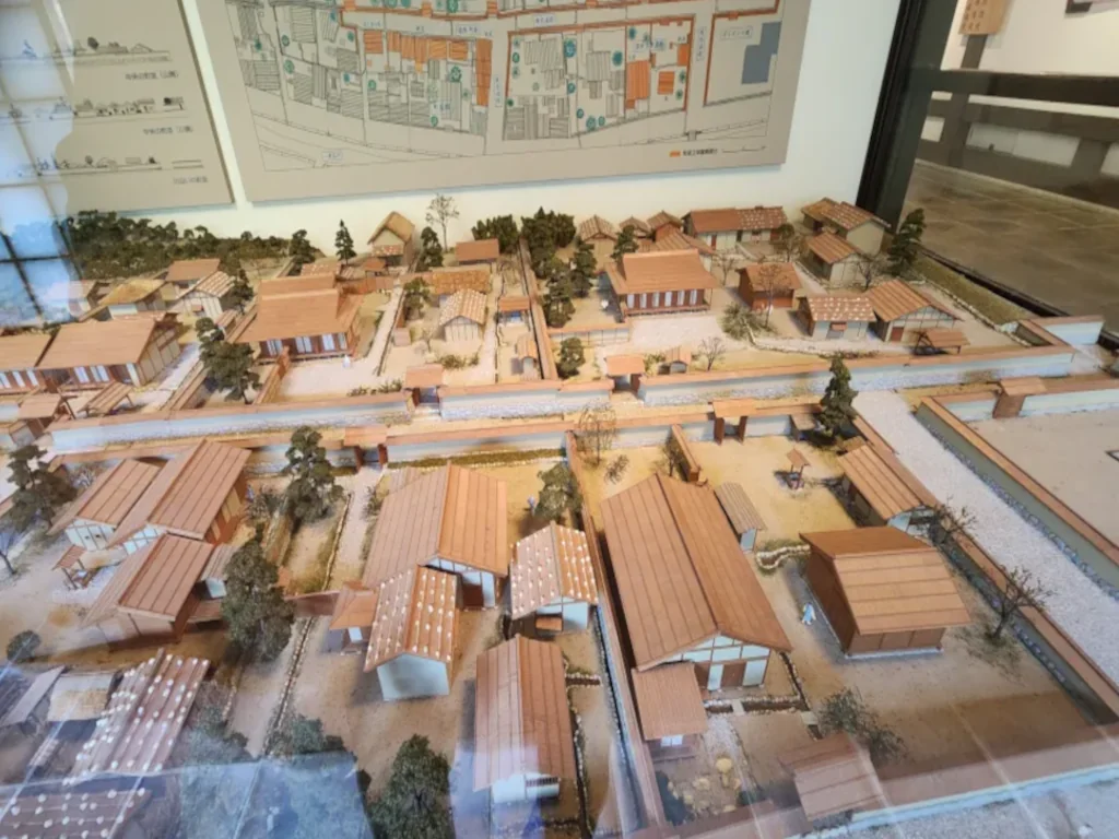
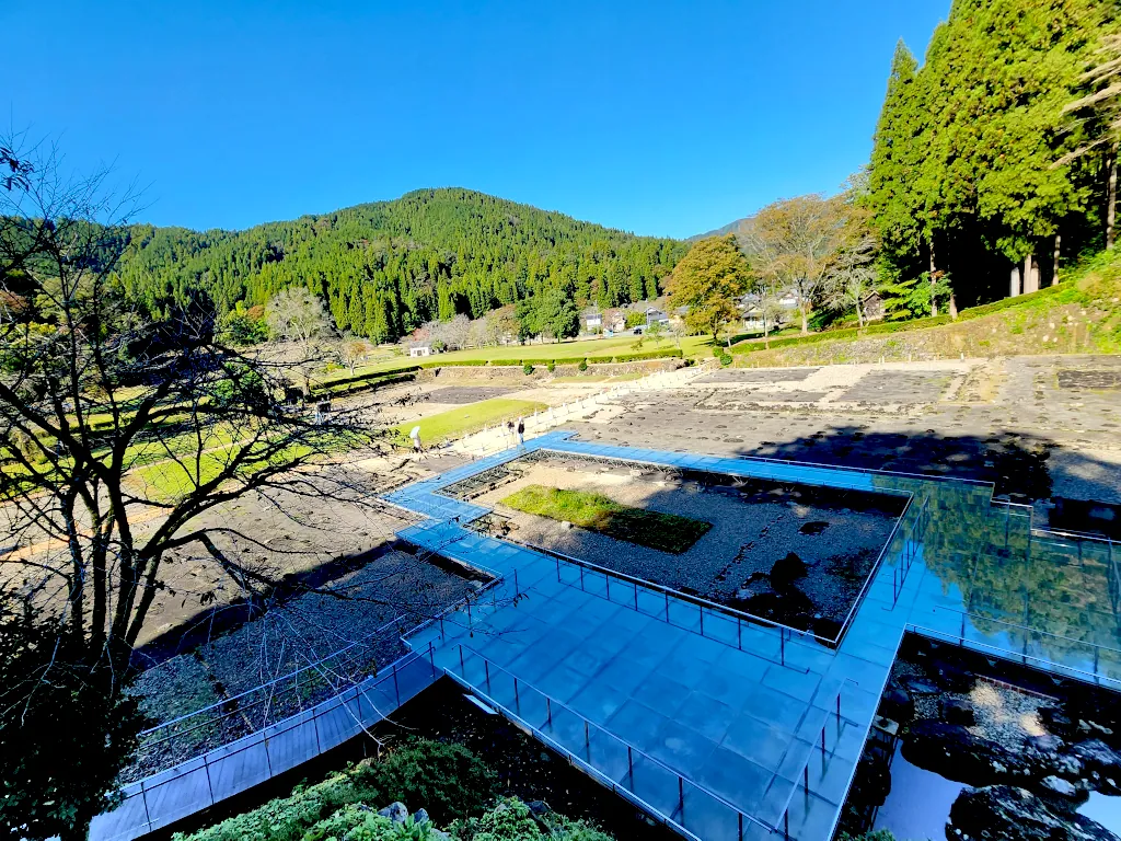
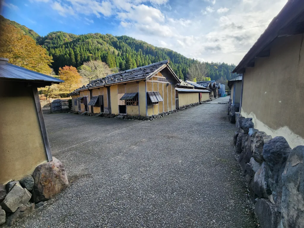
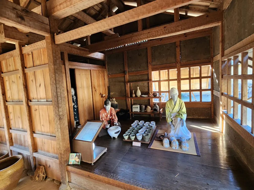
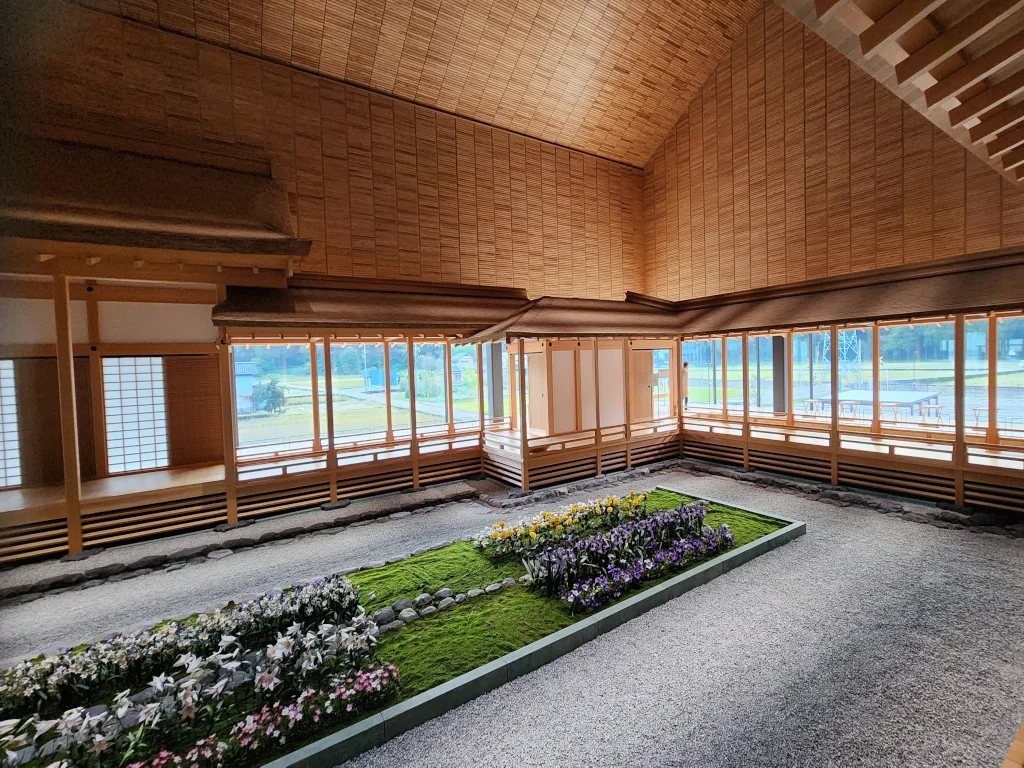
What makes Ichijodani especially valuable today is scale: the ruins are not just a castle footprint, but a broad urban landscape with residential zones, roads, gardens, workshops, and ritual spaces. The site reads as a complete valley city rather than a single monument.
The Asakura leadership consolidated Echizen power and established Ichijodani as a strategic seat, organizing the valley as a controlled urban and military core.
Beyond military function, the city developed into a place of governance, ritual life, craft production, and elite culture connected to broader political networks.
During the late Sengoku wars, forces led by Oda Nobunaga broke Asakura resistance. Ichijodani was attacked and much of the castle city was burned, ending its role as a living political center.
After destruction, the valley shifted back to agriculture and scattered settlement. Without an urban rebuild over the core site, the buried city remained under fields and soil for centuries.
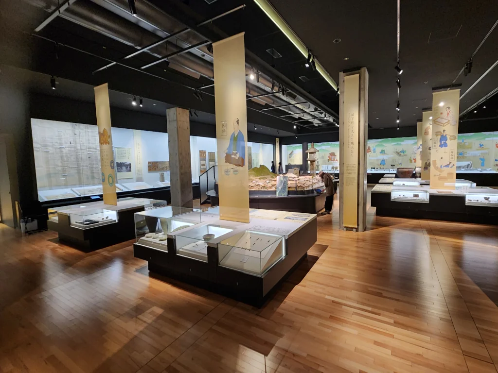
Large-scale excavations that began in the 1960s revealed streets, residences, gardens, and craft areas. Reconstruction and museum interpretation now make the valley readable as a full castle-town landscape.
Ichijodani's destruction was tied directly to high-intensity Sengoku power conflict. Once the Asakura leadership line failed militarily, the valley capital could not hold.
After 1573, the city no longer functioned as a castle capital. The valley remained active as rural land, but the original city fabric was gradually buried and visually erased.
Use the museum model first, then walk the valley as a connected city plan rather than a single landmark.
The Takao area should be read as part of the larger Echizen valley network that sustained Ichijodani. It was not a court center, but a working rural zone connected to agricultural production, river movement, and daily provisioning for settlements linked to the Asakura domain.
Fields, water channels, and seasonal crop cycles in and around Takao supported food systems that fed nearby population centers and travelers moving through the valley.
The Takao-to-Ichijodani river route reflects historical movement patterns: practical lines for people, goods, and communication between rural settlements and urban authority.
Local springs, forest edges, and shrines in Takao preserve continuity with older lifeways. Your existing Chin no Mizu tradition and village shrine context fit this wider system.
The most practical sequence is museum first, then valley walk, then a transfer through the Takao side route if you want to read the wider support landscape in the same day.
Combine Ichijodani, Takao village context, and Tojinbo coast for a single coherent regional story.